
Business Details
Professional Drone Services in Atlanta, GA
At Drone Services of Georgia, we revolutionize how businesses harness drone technology through professional aerial photography, videography, and specialized data solutions. Our FAA-certified pilots and advanced drones deliver high-resolution imagery and actionable insights for construction, real estate, agriculture, and infrastructure sectors. With a focus on compliance and precision, we provide tailored services including construction progression monitoring, GIS mapping, asset inspections, and 3D modeling.Our team combines technical expertise with creative vision to elevate marketing efforts, streamline project management, and support data-driven decision-making. Headquartered in Atlanta, we serve clients across Georgia, the Southeast, and the Mid-West, offering flexible scheduling and rapid turnaround times. Our commitment to innovation ensures clients access cutting-edge technology while maintaining strict adherence to federal and state regulations.
Services
Aerial Photography
Drone Videography
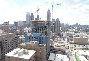
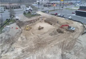
Construction Progression
GIS Mapping
Precision Agriculture
Asset Inspections
Commercial Real Estate Photography
Residential Real Estate Photography
Drone Inspection
Photogrammetry
Highlights and features
- We offer FAA-certified pilots with advanced drone technology for compliant operations.
- Our team delivers rapid turnaround times on high-resolution aerial data projects.
- We provide customizable service schedules for construction progression and asset monitoring.
- Our pilots maintain visual observers for enhanced safety during complex missions.
- We specialize in industry-specific deliverables for real estate, agriculture, and infrastructure.
Associations and certifications
- FAA Part 107 sUAS Endorsement
- FAA Cleared Operations
Services
Aerial Photography
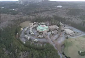
Our aerial photography captures high-resolution images from unique perspectives using FAA-certified drones. This service helps real estate agents showcase properties, construction managers track project progress, and businesses create marketing content. The imagery provides spatial context and visual impact for commercial and residential applications.
Drone Videography
Professional drone videography services produce broadcast-quality footage for marketing campaigns, project documentation, and event coverage. Our FAA-licensed pilots use stabilized cameras to create cinematic content that highlights property features, construction milestones, and environmental landscapes while maintaining regulatory compliance.
Construction Progression
Construction progression tracking uses regular drone flights to document development stages and monitor timelines. This service enables project managers to identify delays, verify milestones, and maintain quality control through comparative imagery analysis. Clients receive time-lapse documentation and progress reports for stakeholder communication.
GIS Mapping
GIS mapping services generate precise topographical data and 3D models for land development and infrastructure planning. Our drones collect spatial information that supports surveying, environmental assessments, and asset management. The data integrates with mapping software for analytical and planning purposes.
Asset Inspections
Drone-based asset inspections safely evaluate hard-to-reach structures like roofs, towers, and industrial equipment. Thermal imaging and high-resolution cameras identify maintenance issues without requiring physical access. This service reduces safety risks and downtime while providing detailed condition assessments for commercial clients.
Questions
What industries do Drone Services of Georgia specialize in?
We specialize in construction, real estate, agriculture, infrastructure, telecommunications, and environmental sectors with tailored drone solutions.
Are your drone operators FAA-certified?
Yes, all our pilots hold FAA Part 107 sUAS certifications and maintain visual observers for safe operations.
What geographic areas do you service?
We operate throughout Georgia, the Southeast, and Mid-West regions from our Atlanta headquarters.
How quickly can you complete a drone project?
We offer flexible scheduling with turnaround times ranging from single-day projects to recurring monthly services.
What deliverables do you provide with aerial data?
We deliver high-resolution images, edited videos, GIS maps, 3D models, and detailed inspection reports.