Business Details
8 Years
experience
Professional Drone Services in Sherman, TX
Brads Drones TX was founded in 2018 by Brad Bigham, a FAA-certified drone pilot with extensive experience in aerial photography, videography, and mapping. Our team specializes in delivering high-quality drone services for construction documentation, photogrammetry, and LIDAR mapping, utilizing advanced technology and LAANC airspace authorization capabilities. We maintain a $5 million liability insurance policy and collaborate with industry professionals to ensure precise data acquisition for surveying and engineering projects. Our commitment to safety, compliance, and technical expertise positions us as a trusted partner for commercial drone operations in Texas. 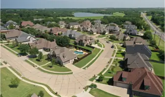
Services
Drone Photography
Videography
Photogrammetry Mapping
LIDAR Mapping
Construction Documentation
Drone Training
RTK Network Access
Payload Sales
Mapping Software
Equipment Sales
Details
- Year established: 2018
Highlights and features
- We are FAA-certified drone pilots with hundreds of operational flight hours.
- Our $5 million liability insurance policy ensures client protection and compliance.
- We specialize in LAANC airspace authorization for restricted area operations.
- Our team combines law enforcement and commercial drone expertise.
- We provide end-to-end support for photogrammetry and LIDAR mapping projects.
Services
Drone Photography
Our FAA-certified pilots capture high-resolution aerial photographs using advanced drone technology. This service supports real estate marketing, construction documentation, and event coverage with precise camera control and GPS positioning. Clients receive professional-grade imagery for commercial and industrial applications.
LIDAR Mapping
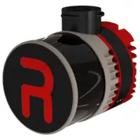
We provide LIDAR-based topographic mapping solutions for land development and infrastructure projects. Using RESEPI payloads and WISPR platforms, we generate accurate elevation models and contour maps. This technology supports civil engineering and environmental planning with centimeter-level precision.
Photogrammetry Mapping
Our photogrammetry services create detailed 3D models from aerial imagery. Using RTK and PPK technologies, we deliver survey-grade maps for construction progress tracking and land management. This service integrates with GIS software for engineering and architectural applications.
Drone Training
We offer hands-on drone operation training for commercial pilots. The curriculum covers FAA regulations, flight safety protocols, and mission planning. Students learn with industry-standard equipment and receive guidance on airspace authorization processes.
RTK Network Access
Our RTK network service provides real-time positioning corrections through GEODNET's global reference stations. This enables centimeter-accurate drone surveys and mapping operations. Clients access reliable GNSS corrections for construction, agriculture, and geospatial projects.
People
Brad Bigham
Owner/Operator
Brad Bigham is a FAA-certified drone pilot and full-time police officer who established Sherman PD's drone program. With hundreds of flight hours, he specializes in commercial drone operations for mapping and documentation.
Questions
What drone services do you offer?
We provide aerial photography, LIDAR mapping, photogrammetry, construction documentation, and FAA-compliant drone training programs.
Are your pilots FAA-certified?
Yes, all our drone operators hold current FAA certifications with hundreds of documented flight hours.
Do you sell drone equipment?
Yes, we offer WISPR systems, DJI products, RESEPI LIDAR payloads, and Emlid GNSS receivers for commercial applications.
Can you operate in restricted airspace?
Our team has FAA LAANC authorization capabilities and successfully obtains airspace permissions for complex operations.
What insurance coverage do you have?
We maintain a $5 million liability insurance policy for all commercial drone operations and equipment sales.
Videos